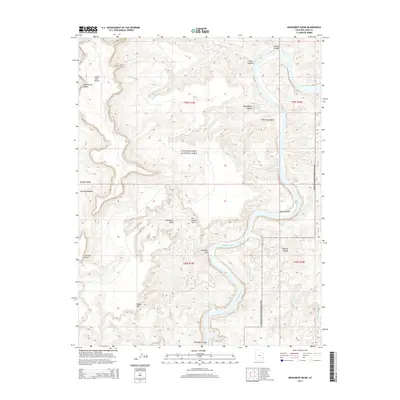
2014 Map of Monument Basin
USGS Topo · Published 2014About this map
Canyonlands National Park defines this corner of San Juan County, where the desert floor drops away into a complex of deep drainage systems. The landscape is dominated by the erosion patterns of the Colorado River, which carves through Meander Canyon and past Sheep Bottom. High overlooks like Grand View Point and the Murphy Range provide vantage points over the inner canyons, including Gooseberry Canyon and Dog Leg Canyon. Below these heights, the White Rim forms a distinct topographic bench that separates the upper plateaus from the river-level basins.
Find a feature on this map
23 named features on this map. Tap any name to fly to it.
Don’t see what you’re looking for? This feature index may not catch every label — zoom into the map to look around manually.
Map Details
Editions of this 2014 Monument Basin Map
This is the sole edition of this map. No revisions or reprints were ever made.
Other maps of this area

1885 · La Sal
USGS Topo · 1:250,000

1951 · Upheaval Dome
USGS Topo · 1:62,500

1952 · Carlisle 2 SE
USGS Topo · 1:24,000

1952 · Carlisle 2 NW
USGS Topo · 1:24,000

1952 · Carlisle 2 NE
USGS Topo · 1:24,000

1952 · Carlisle 2 SW
USGS Topo · 1:24,000

1953 · Carlisle 3 NW
USGS Topo · 1:24,000

1953 · The Needles
USGS Topo · 1:62,500

1954 · Carlisle 4 NW
USGS Topo · 1:24,000

1954 · Carlisle 1 NW
USGS Topo · 1:24,000