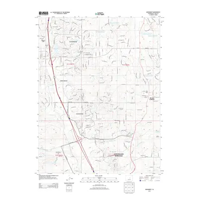
2013 Map of Monument
USGS Topo · Published 2013About this map
Monument and Woodmoor serve as central hubs in this landscape, situated along the I-25 corridor between Colorado Springs and the northern reaches of El Paso County. The map reveals a dense network of suburban development and ranching heritage, with large properties like Wissler Ranch and Misty Acres Ranch bordering organized communities. To the south, the presence of the United States Air Force Academy Cemetery and Gleneagle indicates the military and residential expansion defining this region. Water management is a prominent theme, evidenced by the series of reservoirs along West Cherry Creek, including W Cherry Cr Detention Number 1 Reservoir through Number 6. Local history is preserved at the Mount Herman Grange and several traditional burial sites like Monument Cemetery and Saint Matthias Cemetery.
Find a feature on this map
254 named features on this map. Tap any name to fly to it.
Don’t see what you’re looking for? This feature index may not catch every label — zoom into the map to look around manually.
Map Details
Editions of this 2013 Monument Map
This is the sole edition of this map. No revisions or reprints were ever made.
Other maps of this area

1893 · Colorado Springs
USGS Topo · 1:125,000

1894 · Castle Rock
USGS Topo · 1:125,000

1909 · Colorado Springs
USGS Topo · 1:125,000

1913 · Castle Rock
USGS Topo · 1:125,000

1940 · Elbert
USGS Topo · 1:62,500

1942 · Colorado Springs
USGS Topo · 1:125,000

1944 · Elbert
USGS Topo · 1:62,500

1948 · Colorado Springs
USGS Topo · 1:62,500

1948 · Pikeview
USGS Topo · 1:24,000

1948 · Cascade
USGS Topo · 1:24,000