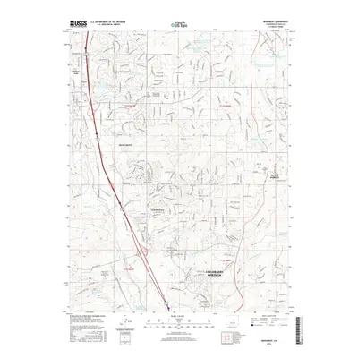
2016 Map of Monument
USGS Topo · Published 2016About this map
Monument and the northern reaches of Colorado Springs serve as the anchors for this mid-2010s landscape, where residential development meets the high plains and foothills. The map reveals a complex water management system characterized by the West Cherry Creek Detention Number 2 Reservoir and several other numbered detention basins along W Cherry Cr. Significant institutional landmarks are present, including the northern edge of the United States Air Force Academy Cem and the AFA Falcon Trail Loop. From the established community of Palmer Lake to the residential enclaves of Woodmoor and Gleneagle, the area is knit together by historic routes and modern thoroughfares like the Santa Fe Regional Trail, which follows the old rail corridor through the heart of the valley near Monument Cr.
Find a feature on this map
42 named features on this map. Tap any name to fly to it.
Don’t see what you’re looking for? This feature index may not catch every label — zoom into the map to look around manually.
Map Details
Editions of this 2016 Monument Map
This is the sole edition of this map. No revisions or reprints were ever made.
Other maps of this area

1893 · Colorado Springs
USGS Topo · 1:125,000

1894 · Castle Rock
USGS Topo · 1:125,000

1909 · Colorado Springs
USGS Topo · 1:125,000

1913 · Castle Rock
USGS Topo · 1:125,000

1940 · Elbert
USGS Topo · 1:62,500

1942 · Colorado Springs
USGS Topo · 1:125,000

1944 · Elbert
USGS Topo · 1:62,500

1948 · Colorado Springs
USGS Topo · 1:62,500

1948 · Pikeview
USGS Topo · 1:24,000

1948 · Cascade
USGS Topo · 1:24,000