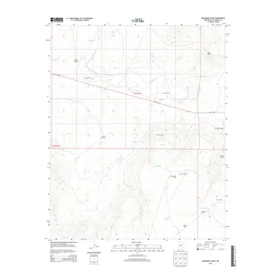
2013 Map of Monument Point
USGS Topo · Published 2013About this map
San Lorenzo Cem stands as a primary historical marker in this ranching landscape of northeastern New Mexico, situated just north of the NM-104 corridor. The terrain is defined by the carved path of the Canadian River, which separates the northern Chical Mesa from the southern heights of Mesa Rica and Monument Point. This 2013 survey illustrates an arid environment where water management is critical to the local economy, evidenced by a dense network of windmills and tanks like Tito Tank, Mistake Tank, and the Lower Oso Windmill.
Find a feature on this map
29 named features on this map. Tap any name to fly to it.
Don’t see what you’re looking for? This feature index may not catch every label — zoom into the map to look around manually.
Map Details
Editions of this 2013 Monument Point Map
This is the sole edition of this map. No revisions or reprints were ever made.
Other maps of this area

1930 · Tucumcari
USGS Topo · 1:125,000

1954 · Santa Fe
USGS Topo · 1:250,000

1954 · Tucumcari
USGS Topo · 1:250,000

1958 · Santa Fe
USGS Topo · 1:250,000

1958 · Tucumcari
USGS Topo · 1:250,000

1964 · Muniz Canyon
USGS Topo · 1:24,000

1964 · Ortega Tank
USGS Topo · 1:24,000

1967 · Tenaja Mesa
USGS Topo · 1:24,000

1967 · Monument Point
USGS Topo · 1:24,000

1968 · La Cinta Mesa
USGS Topo · 1:24,000