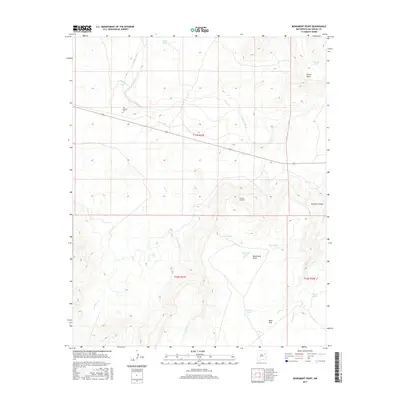
2017 Map of Monument Point
USGS Topo · Published 2017About this map
San Lorenzo Cem stands as a focal point for local history on this high plains landscape of San Miguel County. The terrain is defined by dramatic elevation changes, notably where Chical Mesa and Mesa Rica overlook the winding course of the Canadian River. The presence of Tunnel Number 2 suggests the engineering required to navigate this relief, while numerous named water catchments like Tito Tank and Mistake Tank illustrate the critical nature of water management in this arid region. The network of drainages, including La-Manga Cr, Chical Cr, and Oso Cr, carve deep into the plateaus, creating natural corridors such as Alamosa Canyon. This 2017 survey reflects the enduring cattle-ranching and land-management patterns of the New Mexico interior.
Find a feature on this map
25 named features on this map. Tap any name to fly to it.
Don’t see what you’re looking for? This feature index may not catch every label — zoom into the map to look around manually.
Map Details
Editions of this 2017 Monument Point Map
This is the sole edition of this map. No revisions or reprints were ever made.
Other maps of this area

1930 · Tucumcari
USGS Topo · 1:125,000

1954 · Santa Fe
USGS Topo · 1:250,000

1954 · Tucumcari
USGS Topo · 1:250,000

1958 · Santa Fe
USGS Topo · 1:250,000

1958 · Tucumcari
USGS Topo · 1:250,000

1964 · Muniz Canyon
USGS Topo · 1:24,000

1964 · Ortega Tank
USGS Topo · 1:24,000

1967 · Tenaja Mesa
USGS Topo · 1:24,000

1967 · Monument Point
USGS Topo · 1:24,000

1968 · La Cinta Mesa
USGS Topo · 1:24,000