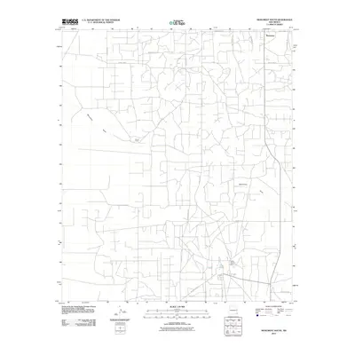
2010 Map of Monument South
USGS Topo · Published 2010About this map
Monument lies at the northern edge of this high plains landscape, situated within a vast network of local infrastructure in Lea County. The terrain is defined by the winding course of Monument Draw, which cuts through the region from northwest to southeast. This 2010 survey reveals a highly developed grid of service roads and industrial sites, notably the Hobbs Chemical Plant in the southeast quadrant and the isolated Record Ranch further west.
Find a feature on this map
21 named features on this map. Tap any name to fly to it.
Don’t see what you’re looking for? This feature index may not catch every label — zoom into the map to look around manually.
Map Details
Editions of this 2010 Monument South Map
This is the sole edition of this map. No revisions or reprints were ever made.
Other maps of this area

1954 · Hobbs
USGS Topo · 1:250,000

1958 · Hobbs
USGS Topo · 1:250,000

1963 · Oil Center
USGS Topo · 1:62,500

1963 · Monument
USGS Topo · 1:62,500

1969 · Hobbs SW
USGS Topo · 1:24,000

1969 · Eunice
USGS Topo · 1:24,000

1969 · Hobbs West
USGS Topo · 1:24,000

1978 · Jal
USGS Topo · 1:100,000

1984 · Oil Center
USGS Topo · 1:24,000
1984 · San Simon Ranch
USGS Topo · 1:24,000