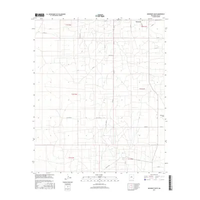
2017 Map of Monument South
USGS Topo · Published 2017About this map
Monument sits at the northern edge of this high-plains landscape in Lea County, serving as the primary hub for a network of rural roads that crisscross the arid terrain. The landscape is defined by the ephemeral Monument Draw, which snakes through the eastern sections, and a dense grid of utility and ranch access routes. Local infrastructure is highly developed around family and ranch names, seen in corridors like Childress Rd, Byrd Ranch Ln, and S Brady Ln. The presence of Kily and various unnamed structural footprints suggest a region deeply tied to the energy industry and cattle ranching typical of southeastern New Mexico. Surveyed boundaries for t19s r37e and t20s r36e organize the territory, while major arteries like Monument Hwy provide the essential connections to the wider Permian Basin region.
Find a feature on this map
30 named features on this map. Tap any name to fly to it.
Don’t see what you’re looking for? This feature index may not catch every label — zoom into the map to look around manually.
Map Details
Editions of this 2017 Monument South Map
This is the sole edition of this map. No revisions or reprints were ever made.
Other maps of this area

1954 · Hobbs
USGS Topo · 1:250,000

1958 · Hobbs
USGS Topo · 1:250,000

1963 · Oil Center
USGS Topo · 1:62,500

1963 · Monument
USGS Topo · 1:62,500

1969 · Hobbs SW
USGS Topo · 1:24,000

1969 · Eunice
USGS Topo · 1:24,000

1969 · Hobbs West
USGS Topo · 1:24,000

1978 · Jal
USGS Topo · 1:100,000

1984 · Oil Center
USGS Topo · 1:24,000
1984 · San Simon Ranch
USGS Topo · 1:24,000