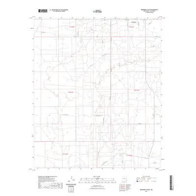
2023 Map of Monument South
USGS Topo · Published 2023About this map
Monument anchors the northern edge of this high-desert landscape in Lea, New Mexico, where the grid of public land surveys meets a complex web of ranch and service roads. The geography is defined by a network of thoroughfares including the Monument Hwy, Geronimo Rd, and Byrd Ranch Ln, reflecting the modern rural infrastructure of the Llano Estacado. The terrain is marked by distinctive local names such as Tuffy Copper Rd and S Brady Ln, which point to the area's agricultural and ranching heritage. Farther south, the transition between township boundaries like t20s r37e and t21s r36e is traced by isolated tracks such as Kily Rd and Boundary No Rd. This map provides a clear view of the contemporary land use patterns and property divisions in this corner of the state.
Find a feature on this map
27 named features on this map. Tap any name to fly to it.
Don’t see what you’re looking for? This feature index may not catch every label — zoom into the map to look around manually.
Map Details
Editions of this 2023 Monument South Map
This is the sole edition of this map. No revisions or reprints were ever made.
Other maps of this area

1954 · Hobbs
USGS Topo · 1:250,000

1958 · Hobbs
USGS Topo · 1:250,000

1963 · Oil Center
USGS Topo · 1:62,500

1963 · Monument
USGS Topo · 1:62,500

1969 · Hobbs SW
USGS Topo · 1:24,000

1969 · Eunice
USGS Topo · 1:24,000

1969 · Hobbs West
USGS Topo · 1:24,000

1978 · Jal
USGS Topo · 1:100,000

1984 · Oil Center
USGS Topo · 1:24,000
1984 · San Simon Ranch
USGS Topo · 1:24,000