
1921 Map of Monument Spring
USGS Topo · Published 1921About this map
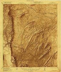
Marathon and the surrounding Brewster County landscape are defined here by a network of cattle ranches and historic outposts just after the First World War. The cattle economy is evidenced by numerous family-named holdings such as Skinner Ranch, Arnold Ranch, and Bourland Ranch, which are connected by trails and the tracks of the Southern Pacific System. The presence of Old Fort Pena Colorada near the center of the sheet points to the region's earlier military history and the importance of permanent water sources like Pena Creek.
Find a feature on this map
37 named features on this map. Tap any name to fly to it.
Don’t see what you’re looking for? This feature index may not catch every label — zoom into the map to look around manually.
Map Details
Editions of this 1921 Monument Spring Map
4 editions found
Other maps of this area

1895 · Alpine
USGS Topo · 1:125,000

1917 · Santiago Peak
USGS Topo · 1:62,500

1917 · Buck Hill
USGS Topo · 1:62,500

1917 · Hood Spring
USGS Topo · 1:62,500

1918 · Bone Spring
USGS Topo · 1:125,000

1918 · Hood Spring
USGS Topo · 1:62,500

1918 · Buck Hill
USGS Topo · 1:62,500

1918 · Santiago Peak
USGS Topo · 1:62,500

1920 · Monument Spring
USGS Topo · 1:62,500

1920 · Marathon
USGS Topo · 1:62,500