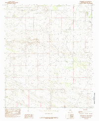
1985 Map of Monument SW
USGS Topo · Published 1985About this map
Monument Draw cuts a distinct path through this section of Lea County, serving as the primary geographic marker in a landscape shaped by the High Plains of Southeast New Mexico. This 1985 provisional survey, based on aerial photography from the late 1970s, documents a transition in the region's land use as the oil and gas industry continued its expansion across the Permian Basin. The map's contouring reveals the subtle relief and drainage patterns typical of the Llano Estacado, providing a snapshot of the terrain before later decades of industrial development and infrastructure projects altered the local topography. While the map is sparse in named settlements, it remains a critical record for researchers tracing the historical boundaries and natural hydrology of the area during the mid-1980s.
Find a feature on this map
1 named feature on this map. Tap any name to fly to it.
Don’t see what you’re looking for? This feature index may not catch every label — zoom into the map to look around manually.
Map Details
Editions of this 1985 Monument SW Map
This is the sole edition of this map. No revisions or reprints were ever made.
Other maps of this area

1954 · Hobbs
USGS Topo · 1:250,000

1958 · Hobbs
USGS Topo · 1:250,000

1963 · Oil Center
USGS Topo · 1:62,500

1963 · Monument
USGS Topo · 1:62,500

1963 · Laguna Gatuna
USGS Topo · 1:62,500

1963 · Hat Mesa
USGS Topo · 1:62,500

1978 · Jal
USGS Topo · 1:100,000

1984 · Oil Center
USGS Topo · 1:24,000

1984 · Lea
USGS Topo · 1:24,000

1984 · Ironhouse Well
USGS Topo · 1:24,000