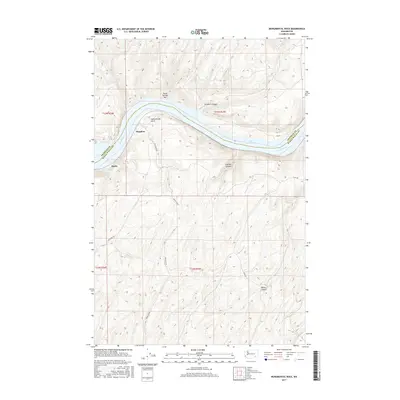
2017 Map of Monumental Rock
USGS Topo · Published 2017About this map
Snake River carving through the plateau defines the landscape of this region on the border of Franklin and Walla Walla counties. The waterway dominates the northern half of the sheet, widening into Lake Herbert G. W. as it flows past geographical landmarks like Three Springs Bar and the namesake Monumental Rock. This 2017 survey illustrates the sparse settlement patterns and heavy reliance on the river topography for orientation in this part of Washington.
Find a feature on this map
17 named features on this map. Tap any name to fly to it.
Don’t see what you’re looking for? This feature index may not catch every label — zoom into the map to look around manually.
Map Details
Editions of this 2017 Monumental Rock Map
This is the sole edition of this map. No revisions or reprints were ever made.
Other maps of this area

1915 · Wallulah
USGS Topo · 1:96,000

1916 · Connell
USGS Topo · 1:125,000

1918 · Connell
USGS Topo · 1:125,000

1918 · Wallula
USGS Topo · 1:125,000

1919 · Walla Walla
USGS Topo · 1:125,000

1921 · Walla Walla
USGS Topo · 1:125,000

1948 · Ayer
USGS Topo · 1:62,500

1950 · Haas
USGS Topo · 1:62,500

1953 · Walla Walla
USGS Topo · 1:250,000

1958 · Walla Walla
USGS Topo · 1:250,000