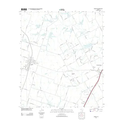
2012 Map of Moody
USGS Topo · Published 2012About this map
The agricultural landscape of Moody and Bruceville-Eddy is defined by an extensive water-management network, with numerous Soil Conservation Service reservoirs scattered throughout the McLennan County countryside. These features, such as Soil Conservation Service Site 21 Reservoir and John M Brinegar Reservoir, underscore the importance of flood control and irrigation in this prairie region. The map captures the transition between the established town centers and the surrounding ranch land, where local landmarks like the Rolling Hills Country Club Lake and McGinnes Lake provide community focal points.
Find a feature on this map
139 named features on this map. Tap any name to fly to it.
Don’t see what you’re looking for? This feature index may not catch every label — zoom into the map to look around manually.
Map Details
Editions of this 2012 Moody Map
This is the sole edition of this map. No revisions or reprints were ever made.
Other maps of this area

1892 · Temple
USGS Topo · 1:125,000

1924 · Temple 2-C
USGS Topo · 1:48,000

1924 · Temple 3-B
USGS Topo · 1:48,000

1931 · Mc Gregor
USGS Topo · 1:62,500

1931 · Belton
USGS Topo · 1:62,500

1954 · Waco
USGS Topo · 1:250,000

1955 · Waco
USGS Topo · 1:250,000

1957 · Bruceville
USGS Topo · 1:24,000

1957 · Lorena
USGS Topo · 1:24,000
1963 · Belfalls
USGS Topo · 1:24,000