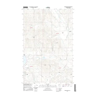
2017 Map of Moon Mountain
USGS Topo · Published 2017About this map
Inchelium and the high-elevation basin of the Twin Lakes anchor this map of the Colville Reservation landscape. The terrain transitions from the lower Seyler Valley to prominent peaks such as Stranger Mtn and Moon Mountain, with drainage provided by the winding Stranger Cr and Hall Cr. Evidence of water management and rural transit is visible in the Twin Lakes Ditch and the network of Bureau of Indian Affairs routes like Bia RD 1053 and Bia RD 80. Small settlements such as Meteor and Carson Beach indicate localized centers of activity within the timbered hills. The map also documents named ridges like Oregon City Ridge and minor water bodies including Round Lake and Camille Lake, providing a detailed view of Ferry County geography in the early twenty-first century.
Find a feature on this map
43 named features on this map. Tap any name to fly to it.
Don’t see what you’re looking for? This feature index may not catch every label — zoom into the map to look around manually.
Map Details
Editions of this 2017 Moon Mountain Map
This is the sole edition of this map. No revisions or reprints were ever made.
Other maps of this area

1948 · Hunters
USGS Topo · 1:62,500

1948 · Wilmont Creek
USGS Topo · 1:62,500

1950 · Wilmont Creek
USGS Topo · 1:62,500

1950 · Hunters
USGS Topo · 1:62,500

1950 · Inchelium
USGS Topo · 1:62,500

1952 · Twin Lakes
USGS Topo · 1:62,500

1954 · Okanogan
USGS Topo · 1:250,000

1956 · Wilmont Creek
USGS Topo · 1:62,500

1958 · Okanogan
USGS Topo · 1:250,000

1984 · Nespelem
USGS Topo · 1:100,000