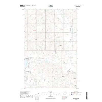
2020 Map of Moon Mountain
USGS Topo · Published 2020About this map
Meteor and the community of Twin Lakes define the lower half of this Ferry County landscape, where the waters of North Twin Lake and South Twin Lake meet the recreation area at Carson Beach. The terrain is characterized by a series of prominent peaks and drainages, including the height of Moon Mtn and the long Oregon City Ridge to the northwest. To the east, Seyler Valley runs parallel to the hills, flanked by Stranger Mtn and the deep cut of Stray Dog Canyon.
Find a feature on this map
45 named features on this map. Tap any name to fly to it.
Don’t see what you’re looking for? This feature index may not catch every label — zoom into the map to look around manually.
Map Details
Editions of this 2020 Moon Mountain Map
This is the sole edition of this map. No revisions or reprints were ever made.
Other maps of this area

1948 · Hunters
USGS Topo · 1:62,500

1948 · Wilmont Creek
USGS Topo · 1:62,500

1950 · Wilmont Creek
USGS Topo · 1:62,500

1950 · Hunters
USGS Topo · 1:62,500

1950 · Inchelium
USGS Topo · 1:62,500

1952 · Twin Lakes
USGS Topo · 1:62,500

1954 · Okanogan
USGS Topo · 1:250,000

1956 · Wilmont Creek
USGS Topo · 1:62,500

1958 · Okanogan
USGS Topo · 1:250,000

1984 · Nespelem
USGS Topo · 1:100,000