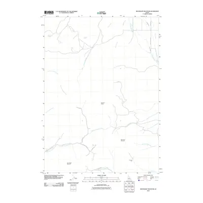
2010 Map of Moonlight Mountain
USGS Topo · Published 2010About this map
Moonlight Mountain and the Pocatello Range anchor this high-elevation landscape in Bannock County, where drainage systems and mountain roads reveal the area's agricultural and mining history. The presence of the Moonlight Mine near Moonlight Creek highlights the local mineral interest, while features like Evening Ditch and Smoke Lateral indicate a complex water management system supporting the drier slopes. Numerous named water sources, including Waterhouse Spring, Big Spring, and Snipe Spring, are scattered across the terrain, serving as critical landmarks for ranchers and early travelers. The road network, including W Moonlight Mine Rd and N Meadows Rd, traces the contours of the land, connecting these remote points of interest to the wider region. In the northern reaches, the South Fork Ross Fork and Indian Creek carve through the foothills, defining the natural boundaries of this rural Idaho expanse.
Find a feature on this map
31 named features on this map. Tap any name to fly to it.
Don’t see what you’re looking for? This feature index may not catch every label — zoom into the map to look around manually.
Map Details
Editions of this 2010 Moonlight Mountain Map
This is the sole edition of this map. No revisions or reprints were ever made.
Other maps of this area

1937 · Pocatello
USGS Topo · 1:48,000

1940 · Blackfoot
USGS Topo · 1:62,500

1943 · Blackfoot
USGS Topo · 1:62,500

1944 · Pocatello
USGS Topo · 1:62,500

1954 · Pocatello
USGS Topo · 1:250,000

1955 · Yandell Springs
USGS Topo · 1:62,500

1955 · Idaho Falls
USGS Topo · 1:250,000

1958 · Idaho Falls
USGS Topo · 1:250,000

1958 · Pocatello
USGS Topo · 1:250,000
1968 · South Putnam Mtn
USGS Topo · 1:24,000