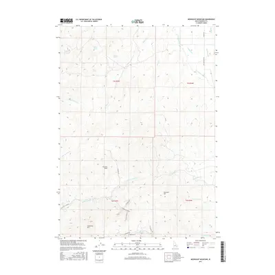
2017 Map of Moonlight Mountain
USGS Topo · Published 2017About this map
Moonlight Mtn and the surrounding Pocatello Range dominate this Idaho landscape, where the terrain is marked by a complex system of drainage and seasonal water sources. The map reveals the critical importance of water management in this arid region, highlighted by the presence of Evening Ditch and the Smoke Lateral in the northeast, alongside numerous named springs such as Waterhouse Spring, Big Horse Spring, and Snipe Spring. These water features suggest the intersection of natural hydrology and ranching or agricultural needs.
Find a feature on this map
35 named features on this map. Tap any name to fly to it.
Don’t see what you’re looking for? This feature index may not catch every label — zoom into the map to look around manually.
Map Details
Editions of this 2017 Moonlight Mountain Map
This is the sole edition of this map. No revisions or reprints were ever made.
Other maps of this area

1937 · Pocatello
USGS Topo · 1:48,000

1940 · Blackfoot
USGS Topo · 1:62,500

1943 · Blackfoot
USGS Topo · 1:62,500

1944 · Pocatello
USGS Topo · 1:62,500

1954 · Pocatello
USGS Topo · 1:250,000

1955 · Yandell Springs
USGS Topo · 1:62,500

1955 · Idaho Falls
USGS Topo · 1:250,000

1958 · Idaho Falls
USGS Topo · 1:250,000

1958 · Pocatello
USGS Topo · 1:250,000
1968 · South Putnam Mtn
USGS Topo · 1:24,000