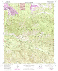
1970 Map of Moonridge
USGS Topo · Published 1988About this map
Sugarloaf Mountain anchors this high-altitude landscape where residential growth meets protected wilderness in the San Bernardino National Forest. The map documents a distinct concentration of institutional retreats and summer camps, such as Promised Land Camp, University Camp, and Camp Akela, clustered around the headwaters of the Santa Ana River. At the base of the peak, the community of Sugarloaf and the developing Woodlands neighborhood show the expansion of permanent settlement into Bear Valley.
Find a feature on this map
92 named features on this map. Tap any name to fly to it.
Don’t see what you’re looking for? This feature index may not catch every label — zoom into the map to look around manually.
Map Details
Editions of this 1970 Moonridge Map
3 editions found
Other maps of this area

1901 · Southern California Sheet No. 1
USGS Topo · 1:250,000

1902 · San Gorgonio
USGS Topo · 1:125,000

1904 · Southern California Sheet No. 1
USGS Topo · 1:250,000

1947 · Lucerne Valley
USGS Topo · 1:62,500

1949 · Lucerne Valley
USGS Topo · 1:62,500

1953 · San Bernardino
USGS Topo · 1:250,000

1954 · San Gorgonio Mountain
USGS Topo · 1:62,500

1955 · Old Woman Springs
USGS Topo · 1:62,500

1955 · Morongo Valley
USGS Topo · 1:62,500

1956 · San Bernardino
USGS Topo · 1:250,000