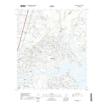
2019 Map of Moonshine Hill
USGS Topo · Published 2019About this map
Humble and the northeastern suburban expansion of Houston meet along the heavily wooded reaches of the East Fork San Jacinto River in this modern survey. The landscape is defined by its transition from older communities like Moonshine Hill and Porter to the extensive residential developments that now ring the northern shores of Lake Houston. The map reveals a dense network of suburban streets and planned communities such as Walden Woods and Timberlane Acres situated among persistent wetland features like Artesian Slough, Ten Acre Lake, and Isabell Lake. The numerous named gullies, including Blackland Gully and Rogers Gully, highlight the intricate natural drainage system that continues to shape urban planning in this low-lying region of Harris and Montgomery Counties. Significant local landmarks like White Oak Cem and the distinctive Black Cat Ridge provide historical anchoring points amidst the rapid growth of the late twenty-first century.
Find a feature on this map
258 named features on this map. Tap any name to fly to it.
Don’t see what you’re looking for? This feature index may not catch every label — zoom into the map to look around manually.
Map Details
Editions of this 2019 Moonshine Hill Map
This is the sole edition of this map. No revisions or reprints were ever made.
Other maps of this area

1916 · Crosby
USGS Topo · 1:24,000

1916 · Harmaston
USGS Topo · 1:24,000

1916 · Moonshine Hill
USGS Topo · 1:24,000

1916 · Huffman
USGS Topo · 1:24,000

1916 · Humble
USGS Topo · 1:24,000

1919 · Humble
USGS Topo · 1:31,680

1919 · Weeden
USGS Topo · 1:31,680

1919 · Crosby
USGS Topo · 1:31,680

1920 · Harmaston
USGS Topo · 1:31,680

1920 · Moonshine Hill
USGS Topo · 1:31,680