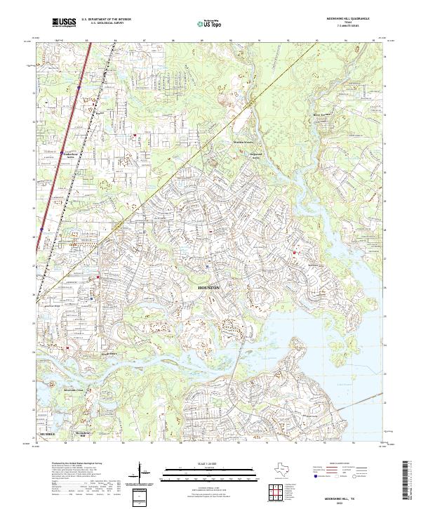
2022 Map of Moonshine Hill
USGS Topo · Published 2022About this map
Houston and its northeastern suburbs dominate this landscape, where residential developments meet the complex waterways of the San Jacinto River system. The map documents the interface between growing residential communities like Porter and Timberlane Acres and the natural drainages of White Oak Cr and Caney Cr. The storied oil history of the region is anchored at Moonshine Hill, while the White Oak Cem remains as a local landmark.
Find a feature on this map
52 named features on this map. Tap any name to fly to it.
Don’t see what you’re looking for? This feature index may not catch every label — zoom into the map to look around manually.
Map Details
Editions of this 2022 Moonshine Hill Map
This is the sole edition of this map. No revisions or reprints were ever made.
Other maps of this area

1916 · Crosby
USGS Topo · 1:24,000

1916 · Harmaston
USGS Topo · 1:24,000

1916 · Moonshine Hill
USGS Topo · 1:24,000

1916 · Huffman
USGS Topo · 1:24,000

1916 · Humble
USGS Topo · 1:24,000

1919 · Humble
USGS Topo · 1:31,680

1919 · Weeden
USGS Topo · 1:31,680

1919 · Crosby
USGS Topo · 1:31,680

1920 · Harmaston
USGS Topo · 1:31,680

1920 · Moonshine Hill
USGS Topo · 1:31,680