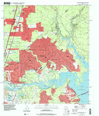
1995 Map of Moonshine Hill
USGS Topo · Published 2000About this map
The East Fork San Jacinto River and West Fork San Jacinto River converge at Lake Houston, defining a landscape of bayous and sprawling suburban development on the edge of Houston. This mid-1990s record documents the transition of the timbered bottomlands of the Montgomery Co and Harris Co border into established residential areas like Kingwood, Timberlane Acres, and Walden Woods. The map illustrates a high density of water features, from natural drainage like Caney Creek and Taylor Gully to smaller named landmarks such as Whiskey Still Pond, Maple Slough, and Artesian Slough.
Find a feature on this map
60 named features on this map. Tap any name to fly to it.
Don’t see what you’re looking for? This feature index may not catch every label — zoom into the map to look around manually.
Map Details
Editions of this 1995 Moonshine Hill Map
This is the sole edition of this map. No revisions or reprints were ever made.
Other maps of this area

1916 · Crosby
USGS Topo · 1:24,000

1916 · Harmaston
USGS Topo · 1:24,000

1916 · Moonshine Hill
USGS Topo · 1:24,000

1916 · Huffman
USGS Topo · 1:24,000

1916 · Humble
USGS Topo · 1:24,000

1919 · Humble
USGS Topo · 1:31,680

1919 · Weeden
USGS Topo · 1:31,680

1919 · Crosby
USGS Topo · 1:31,680

1920 · Harmaston
USGS Topo · 1:31,680

1920 · Moonshine Hill
USGS Topo · 1:31,680