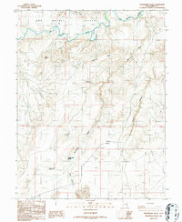
1986 Map of Moonshine Wash
USGS Topo · Published 1987About this map
The San Rafael River meanders across the northern reaches of this Emery County landscape, carving a path through the San Rafael Valley before entering the deeper canyon systems to the east. This 1980s-era topographical survey documents a high desert environment defined by isolated water sources and dramatic elevation changes. Notable landmarks like The Cone and Gruvers Mesa rise above the surrounding terrain, while the intricate drainage of Moonshine Wash and Three Canyon illustrate the erosional forces at work. The map traces several 4WD tracks that provide the only access to remote points like Saddle Horse Spring and Moonshine Spring. In the southern portion, the Saucer Basin Reservoir and Saucer Basin reflect the critical importance of water management in this arid region, providing a detailed view of the natural and man-made hydrology before modern digital mapping.
Find a feature on this map
14 named features on this map. Tap any name to fly to it.
Don’t see what you’re looking for? This feature index may not catch every label — zoom into the map to look around manually.
Map Details
Editions of this 1986 Moonshine Wash Map
This is the sole edition of this map. No revisions or reprints were ever made.
Other maps of this area

1885 · San Rafael
USGS Topo · 1:250,000

1952 · Tidwell 4 SE
USGS Topo · 1:24,000

1952 · Tidwell 4 NE
USGS Topo · 1:24,000

1954 · Tidwell 1 SW
USGS Topo · 1:24,000

1954 · Tidwell 2 SE
USGS Topo · 1:24,000

1954 · Tidwell 1 SE
USGS Topo · 1:24,000

1954 · Tidwell Bottoms
USGS Topo · 1:62,500

1954 · Green River
USGS Topo · 1:62,500

1956 · Salina
USGS Topo · 1:250,000

1960 · Salina
USGS Topo · 1:250,000