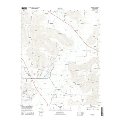
2014 Map of Moontown
USGS Topo · Published 2014About this map
The Flint River carves a central path through this Madison County landscape, separating the high elevations of Drake Mtn and Chestnut Knob from the fertile valley bottoms of Little Cove and Big Cove. This 2014 survey documents a region defined by its diverse terrain, where the aviation activity at Moontown Airport and Frerichs Airport contrasts with the long-established agricultural settlements of Berkley, Brownsboro, and Gurley. Genealogists will find a high density of family burial grounds, including King Cem, Dunkin Cem, and Nelson Chapel Cem, often tucked near historical crossings and coves. The map reveals an intricate network of water features like Hurricane Creek and Peevey Cr, alongside topographical landmarks such as Sublett Bluff and Salty Bottom, which illustrate the rural character persisting on the outskirts of Huntsville.
Find a feature on this map
163 named features on this map. Tap any name to fly to it.
Don’t see what you’re looking for? This feature index may not catch every label — zoom into the map to look around manually.
Map Details
Editions of this 2014 Moontown Map
This is the sole edition of this map. No revisions or reprints were ever made.
Other maps of this area

1888 · Scottsboro
USGS Topo · 1:125,000

1888 · Huntsville
USGS Topo · 1:125,000

1892 · Huntsville
USGS Topo · 1:125,000

1892 · Scottsboro
USGS Topo · 1:125,000

1936 · New Hope
USGS Topo · 1:24,000

1936 · Meridianville
USGS Topo · 1:24,000

1936 · Moontown
USGS Topo · 1:24,000

1936 · Hollytree
USGS Topo · 1:24,000

1936 · Grant
USGS Topo · 1:24,000

1936 · Maysville
USGS Topo · 1:24,000