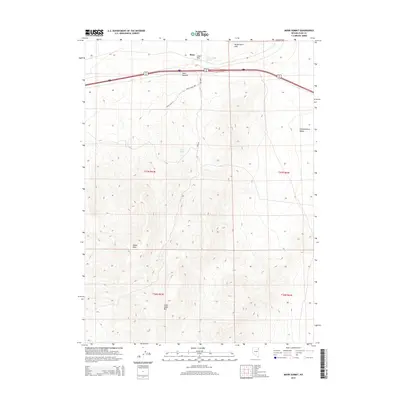
2015 Map of Moor Summit
USGS Topo · Published 2015About this map
Moor sits at a critical high point in the high desert of Elko County, where the Interstate 80 corridor navigates the gap between the Windermere Hills and the Wood Hills. This 2015 survey illustrates the modern transportation infrastructure following the historic path over Moor Summit, a vital pass for transcontinental travel. The landscape is defined by its dramatic elevation changes, rising from Independence Valley up toward the peak of Little Cedar Mtn. Water remains a sparse but essential feature in this arid environment, marked by the presence of Independence Springs and Wadel Spring. Local access is provided by a network of rural routes such as Wadel Spring Way and Moor Rd, which service the ranching and mountainous terrain surrounding Cedar Pass.
Find a feature on this map
16 named features on this map. Tap any name to fly to it.
Don’t see what you’re looking for? This feature index may not catch every label — zoom into the map to look around manually.
Map Details
Editions of this 2015 Moor Summit Map
This is the sole edition of this map. No revisions or reprints were ever made.
Other maps of this area

1955 · Wells
USGS Topo · 1:250,000

1955 · Elko
USGS Topo · 1:250,000

1958 · Wells
USGS Topo · 1:250,000

1958 · Elko
USGS Topo · 1:250,000

1961 · Wells
USGS Topo · 1:250,000

1962 · Elko
USGS Topo · 1:250,000

1965 · Elko
USGS Topo · 1:250,000

1968 · Moor Summit
USGS Topo · 1:24,000

1968 · Holborn
USGS Topo · 1:24,000

1968 · Wells
USGS Topo · 1:24,000