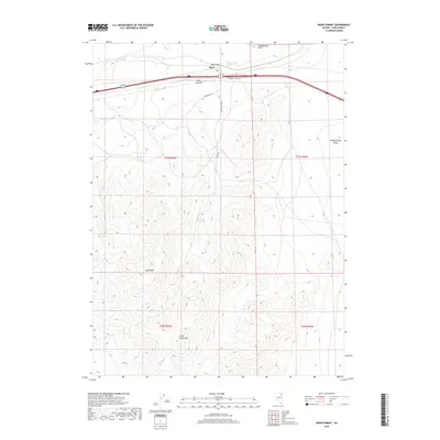
2018 Map of Moor Summit
USGS Topo · Published 2018About this map
Moor sits as a lonely point of reference along the high-desert corridor of northeastern Nevada. This topographic study reveals the stark transition from the open expanse of Independence Valley to the elevated terrain of Moor Summit. The map documents a critical transportation artery cutting through the landscape via Cedar Pass, where Interstate 80 and the railroad share a narrow route between the Windermere Hills to the north and the expansive Wood Hills to the south. Local water sources like Independence Springs provide a glimpse into the hydrology of this arid region. The road network, including Woodhills Ln and Moore Rd, traces the lower slopes of the surrounding heights, while Little Cedar Mtn stands as a prominent landmark in the southwestern quadrant, illustrating the isolated peaks characteristic of this Basin and Range territory.
Find a feature on this map
16 named features on this map. Tap any name to fly to it.
Don’t see what you’re looking for? This feature index may not catch every label — zoom into the map to look around manually.
Map Details
Editions of this 2018 Moor Summit Map
This is the sole edition of this map. No revisions or reprints were ever made.
Other maps of this area

1955 · Wells
USGS Topo · 1:250,000

1955 · Elko
USGS Topo · 1:250,000

1958 · Wells
USGS Topo · 1:250,000

1958 · Elko
USGS Topo · 1:250,000

1961 · Wells
USGS Topo · 1:250,000

1962 · Elko
USGS Topo · 1:250,000

1965 · Elko
USGS Topo · 1:250,000

1968 · Moor Summit
USGS Topo · 1:24,000

1968 · Holborn
USGS Topo · 1:24,000

1968 · Wells
USGS Topo · 1:24,000