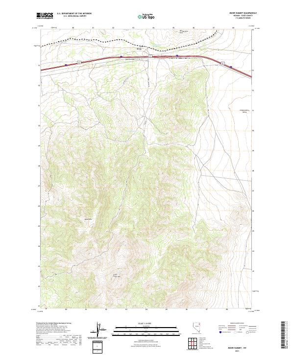
2021 Map of Moor Summit
USGS Topo · Published 2021About this map
Cedar Pass serves as a critical corridor through the high-elevation terrain of northeastern Nevada, where modern transit routes trace the same paths as historic pioneer trails. The small settlement at Moor sits near the highest point of Moor Summit, marking the divide between the Windermere Hills to the north and the extensive Wood Hills to the south. This transition zone is characterized by its reliance on isolated water sources like Independence Springs and Wadel Spring, which were vital for early rangeland survival.
Find a feature on this map
17 named features on this map. Tap any name to fly to it.
Don’t see what you’re looking for? This feature index may not catch every label — zoom into the map to look around manually.
Map Details
Editions of this 2021 Moor Summit Map
This is the sole edition of this map. No revisions or reprints were ever made.
Other maps of this area

1955 · Wells
USGS Topo · 1:250,000

1955 · Elko
USGS Topo · 1:250,000

1958 · Wells
USGS Topo · 1:250,000

1958 · Elko
USGS Topo · 1:250,000

1961 · Wells
USGS Topo · 1:250,000

1962 · Elko
USGS Topo · 1:250,000

1965 · Elko
USGS Topo · 1:250,000

1968 · Moor Summit
USGS Topo · 1:24,000

1968 · Holborn
USGS Topo · 1:24,000

1968 · Wells
USGS Topo · 1:24,000