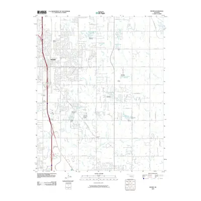
2009 Map of Moore
USGS Topo · Published 2009About this map
Moore serves as the focal point of this suburban and rural landscape, where the expansion of residential streets meets the active resource extraction of the South Moore Oil Field. The area is defined by a complex network of small reservoirs and dams, including Mussel Shoals Lake and Lazy Day Lake, which manage the drainage of the Little River and its various forks. This hydrological system is interspersed with significant local landmarks like the Moore Airpark and the floral landscape of the Lilac Hills Memorial Garden.
Find a feature on this map
76 named features on this map. Tap any name to fly to it.
Don’t see what you’re looking for? This feature index may not catch every label — zoom into the map to look around manually.
Map Details
Editions of this 2009 Moore Map
This is the sole edition of this map. No revisions or reprints were ever made.
Other maps of this area

1892 · Moore
USGS Topo · 1:62,500

1893 · Norman
USGS Topo · 1:62,500

1893 · Oklahoma City
USGS Topo · 1:62,500

1898 · Purcell
USGS Topo · 1:125,000

1904 · Chickasha
USGS Topo · 1:125,000

1925 · Norman NO 2
USGS Topo · 1:24,000

1934 · Crutcho Creek
USGS Topo · 1:24,000

1934 · Moore
USGS Topo · 1:62,500

1936 · Norman
USGS Topo · 1:62,500

1938 · Moore
USGS Topo · 1:62,500