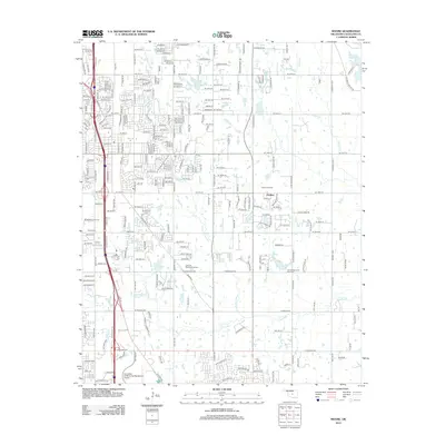
2012 Map of Moore
USGS Topo · Published 2012About this map
The South Moore Oil Field and Clothier Oil Field define the industrial landscape of this region south of Oklahoma City. The map shows a transition from suburban development around Platt Coll and the University of Oklahoma Westheimer Airport to more rural and resource-focused areas to the east. Water resources are central to the terrain, including Stanley Draper Lake, Sooner Lake, and Kitchen Lake, alongside the winding Little River and its N Fork Little River. Local genealogy and community markers are well-documented, from the established Sunset Memorial Park Cem and Smith Cem to the grounds of Hillsdale Free Will Baptist Coll and Lilac Hill Memorial Gardens. This area demonstrates a modern mix of residential growth, education, and energy extraction centered around the Interstate 35 corridor.
Find a feature on this map
122 named features on this map. Tap any name to fly to it.
Don’t see what you’re looking for? This feature index may not catch every label — zoom into the map to look around manually.
Map Details
Editions of this 2012 Moore Map
This is the sole edition of this map. No revisions or reprints were ever made.
Other maps of this area

1892 · Moore
USGS Topo · 1:62,500

1893 · Norman
USGS Topo · 1:62,500

1893 · Oklahoma City
USGS Topo · 1:62,500

1898 · Purcell
USGS Topo · 1:125,000

1904 · Chickasha
USGS Topo · 1:125,000

1925 · Norman NO 2
USGS Topo · 1:24,000

1934 · Crutcho Creek
USGS Topo · 1:24,000

1934 · Moore
USGS Topo · 1:62,500

1936 · Norman
USGS Topo · 1:62,500

1938 · Moore
USGS Topo · 1:62,500