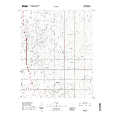
2018 Map of Moore
USGS Topo · Published 2018About this map
The expanding suburban corridor between Moore and Norman is documented in this 2018 survey, capturing a landscape of dense residential grids and significant regional infrastructure. The BNSF Railway serves as a major north-south transport spine, running parallel to the primary arterial roads that connect these growing communities to Oklahoma City. Notable landmarks for researchers include the University of Oklahoma Westheimer Airport in the south and smaller named locales such as Clothier.
Find a feature on this map
225 named features on this map. Tap any name to fly to it.
Don’t see what you’re looking for? This feature index may not catch every label — zoom into the map to look around manually.
Map Details
Editions of this 2018 Moore Map
This is the sole edition of this map. No revisions or reprints were ever made.
Other maps of this area

1892 · Moore
USGS Topo · 1:62,500

1893 · Norman
USGS Topo · 1:62,500

1893 · Oklahoma City
USGS Topo · 1:62,500

1898 · Purcell
USGS Topo · 1:125,000

1904 · Chickasha
USGS Topo · 1:125,000

1925 · Norman NO 2
USGS Topo · 1:24,000

1934 · Crutcho Creek
USGS Topo · 1:24,000

1934 · Moore
USGS Topo · 1:62,500

1936 · Norman
USGS Topo · 1:62,500

1938 · Moore
USGS Topo · 1:62,500