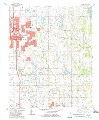
1986 Map of Moore
USGS Topo · Published 1986About this map
Moore and the surrounding borderlands of Oklahoma City and Norman are captured during a decade of rapid suburban expansion in the mid-1980s. The landscape is defined by the Atchison Topeka and Santa Fe Railway and a dense network of residential streets, though pockets of older agricultural and industrial land remain. Notable landmarks include the Municipal Hospital and the sprawling Moore-Norman Voc-Tech Sch.
Find a feature on this map
74 named features on this map. Tap any name to fly to it.
Don’t see what you’re looking for? This feature index may not catch every label — zoom into the map to look around manually.
Map Details
Editions of this 1986 Moore Map
This is the sole edition of this map. No revisions or reprints were ever made.
Other maps of this area

1892 · Moore
USGS Topo · 1:62,500

1893 · Norman
USGS Topo · 1:62,500

1893 · Oklahoma City
USGS Topo · 1:62,500

1898 · Purcell
USGS Topo · 1:125,000

1904 · Chickasha
USGS Topo · 1:125,000

1925 · Norman NO 2
USGS Topo · 1:24,000

1934 · Crutcho Creek
USGS Topo · 1:24,000

1934 · Moore
USGS Topo · 1:62,500

1936 · Norman
USGS Topo · 1:62,500

1938 · Moore
USGS Topo · 1:62,500