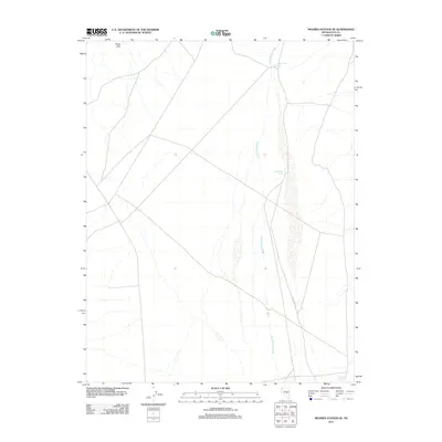
2012 Map of Moores Station SE
USGS Topo · Published 2012About this map
Heart Hills anchors the northwest corner of this desert landscape, where water management defines the arid terrain of Nye County. The intermittent flow of Sand Springs Wash cuts north-to-south through the center, feeding into specific collection points such as Logan Catch Basin and Needles Catch Basin. These features reflect the essential infrastructure required for rangeland or wildlife support in the Great Basin. Toward the southeastern corner, Lava Bed Spring emerges as a rare perennial water source, while Black Lava Rd provides the primary transit corridor through the scrubland. This 2012 survey by the U. S. Geological Survey documents the sparse but critical network of springs and catchments that sustain life in this remote section of Nevada.
Find a feature on this map
6 named features on this map. Tap any name to fly to it.
Don’t see what you’re looking for? This feature index may not catch every label — zoom into the map to look around manually.
Map Details
Editions of this 2012 Moores Station SE Map
This is the sole edition of this map. No revisions or reprints were ever made.
Other maps of this area

1956 · Lund
USGS Topo · 1:250,000

1956 · Tonopah
USGS Topo · 1:250,000

1959 · Tonopah
USGS Topo · 1:250,000

1960 · Lund
USGS Topo · 1:250,000

1962 · Tonopah
USGS Topo · 1:250,000

1967 · Lunar Crater
USGS Topo · 1:62,500

1967 · Moores Station
USGS Topo · 1:62,500

1967 · Moores Station SE
USGS Topo · 1:24,000

1967 · Palisade Mesa
USGS Topo · 1:24,000

1967 · Moores Station
USGS Topo · 1:24,000