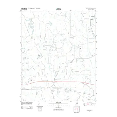
2012 Map of Mooreville
USGS Topo · Published 2012About this map
The community of Mooreville and its surrounding countryside in eastern Mississippi are defined by a network of creeks and small family settlements. In the northern reaches of the quadrangle, Eggville and Shiloh sit amidst a landscape drained by Patch Cr, Sand Cr, and Puncheon Cr. For genealogists, the map is particularly detailed, showing numerous burial sites such as the Union Hill Cem and Baldwin Family Cem.
Find a feature on this map
158 named features on this map. Tap any name to fly to it.
Don’t see what you’re looking for? This feature index may not catch every label — zoom into the map to look around manually.
Map Details
Editions of this 2012 Mooreville Map
This is the sole edition of this map. No revisions or reprints were ever made.
Other maps of this area

1921 · Tupelo
USGS Topo · 1:48,000

1923 · Tupelo
USGS Topo · 1:62,500

1956 · Tupelo
USGS Topo · 1:250,000

1958 · Tupelo
USGS Topo · 1:250,000

1965 · Mooreville
USGS Topo · 1:24,000

1965 · Fulton
USGS Topo · 1:24,000

1965 · Kirkville
USGS Topo · 1:24,000

1966 · Beans Ferry
USGS Topo · 1:24,000

1966 · Evergreen
USGS Topo · 1:24,000

1966 · Verona
USGS Topo · 1:24,000