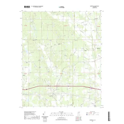
2021 Map of Mooreville
USGS Topo · Published 2021About this map
Mooreville and Mantachie anchor the landscape where the eastern hills of Lee County meet the Itawamba County line. This 2021 edition provides a contemporary view of the region's rural character, dominated by a dense network of family and community burial grounds such as Old Spring Hill Cem, Buncum Cem, and the Baldwin Family Cem. These sites, along with others like the Union Hill Cem near Eggville, serve as vital markers for genealogical research in this part of Mississippi. The terrain is defined by the winding paths of Boguefala Cr and Mantachie Cr, which flow through a mix of timberland and residential development. Modern infrastructure, including the highway corridor between Auburn and Dorsey, has reshaped the traditional agricultural pattern, though smaller settlements like Shiloh and Centerville maintain their distinct local identities.
Find a feature on this map
134 named features on this map. Tap any name to fly to it.
Don’t see what you’re looking for? This feature index may not catch every label — zoom into the map to look around manually.
Map Details
Editions of this 2021 Mooreville Map
This is the sole edition of this map. No revisions or reprints were ever made.
Other maps of this area

1921 · Tupelo
USGS Topo · 1:48,000

1923 · Tupelo
USGS Topo · 1:62,500

1956 · Tupelo
USGS Topo · 1:250,000

1958 · Tupelo
USGS Topo · 1:250,000

1965 · Mooreville
USGS Topo · 1:24,000

1965 · Fulton
USGS Topo · 1:24,000

1965 · Kirkville
USGS Topo · 1:24,000

1966 · Beans Ferry
USGS Topo · 1:24,000

1966 · Evergreen
USGS Topo · 1:24,000

1966 · Verona
USGS Topo · 1:24,000