2024 Map of Mooreville
USGS Topo · Published 2024About this map
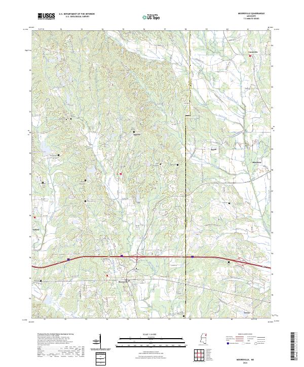
Mooreville sits at the intersection of a complex drainage network where Boguefala Creek and Tulip Creek wind through the landscape. This modern survey illustrates the persistent rural settlement patterns across the Lee Co and Itawamba Co line, characterized by small communities like Eggville, Shiloh, and Mantachie. The geography is defined by its numerous small burial grounds and family plots, such as the Baldwin Family Cem and Sandlin Family Cem, which offer significant value for genealogical research.
Find a feature on this map
116 named features on this map. Tap any name to fly to it.
Don’t see what you’re looking for? This feature index may not catch every label — zoom into the map to look around manually.
Map Details
Editions of this 2024 Mooreville Map
This is the sole edition of this map. No revisions or reprints were ever made.