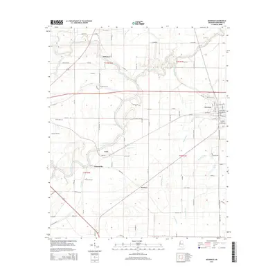
2015 Map of Moorhead
USGS Topo · Published 2015About this map
Moorhead serves as the primary urban center in this Sunflower County landscape, defined by its role as the site of the Mississippi Delta Community Coll. The town’s grid is established between Moorhead Bayou and the rail corridors that historically drove the local economy. Beyond the town limits, the geography is dictated by the winding courses of the Big Sunflower River and the Quiver River, which create a complex network of wetlands and drainage features like Turkeyfoot Brake and Wixon Slough. Small agricultural settlements such as Baird, Johnsonville, and Markham are scattered throughout the region, often positioned near the intricate bayou systems. Genealogists will find several burial sites preserved across the rural landscape, including Bayou Hill Cem, Saint Pauls Cem, and Little Rock Cem, providing physical links to the families who cultivated these delta lands.
Find a feature on this map
75 named features on this map. Tap any name to fly to it.
Don’t see what you’re looking for? This feature index may not catch every label — zoom into the map to look around manually.
Map Details
Editions of this 2015 Moorhead Map
This is the sole edition of this map. No revisions or reprints were ever made.
Other maps of this area

1931 · Schlater
USGS Topo · 1:48,000

1934 · Cleveland
USGS Topo · 1:62,500

1934 · Schlater
USGS Topo · 1:62,500

1939 · Schlater
USGS Topo · 1:62,500

1940 · Baird
USGS Topo · 1:62,500

1940 · Cleveland
USGS Topo · 1:62,500

1953 · Greenwood
USGS Topo · 1:250,000

1956 · Greenwood
USGS Topo · 1:250,000

1961 · Mossy Lake
USGS Topo · 1:62,500
1961 · Schlater
USGS Topo · 1:62,500