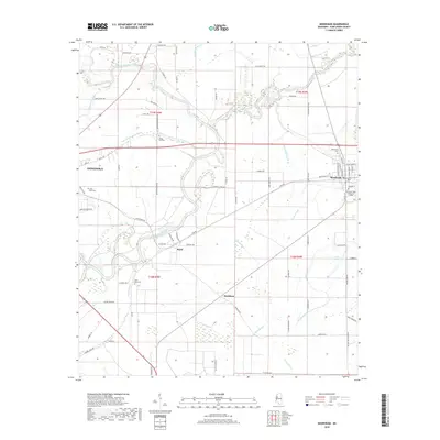
2018 Map of Moorhead
USGS Topo · Published 2018About this map
Big Sunflower River and the Quiver River dominate this delta landscape, carving winding paths through Sunflower County. The map captures the agricultural layout of the region, featuring numerous plantation roads like Eureka Plantation Rd and Kay Plantation Rd that serve the fertile alluvial plains. Small settlements and rural hubs including Baird, Markham, and the eastern portions of Indianola are connected by a network of drainage features such as Moorhead Bayou and Wixon Slough. For genealogists and local historians, several landmarks offer significant research value, most notably the Mississippi Delta Community College campus in Moorhead and several rural burial sites, including Saint Pauls Cem and Bayou Hill Cem. The terrain is characterized by intricate water systems, from the wetlands of Turkeyfoot Brake to the smaller seasonal channels of Shoal Bayou.
Find a feature on this map
84 named features on this map. Tap any name to fly to it.
Don’t see what you’re looking for? This feature index may not catch every label — zoom into the map to look around manually.
Map Details
Editions of this 2018 Moorhead Map
This is the sole edition of this map. No revisions or reprints were ever made.
Other maps of this area

1931 · Schlater
USGS Topo · 1:48,000

1934 · Cleveland
USGS Topo · 1:62,500

1934 · Schlater
USGS Topo · 1:62,500

1939 · Schlater
USGS Topo · 1:62,500

1940 · Baird
USGS Topo · 1:62,500

1940 · Cleveland
USGS Topo · 1:62,500

1953 · Greenwood
USGS Topo · 1:250,000

1956 · Greenwood
USGS Topo · 1:250,000

1961 · Mossy Lake
USGS Topo · 1:62,500
1961 · Schlater
USGS Topo · 1:62,500