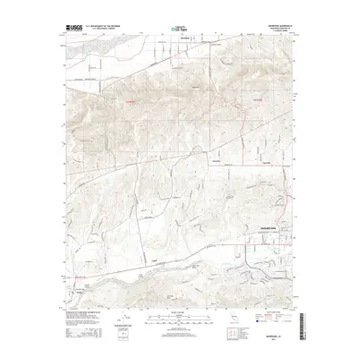
2015 Map of Moorpark
USGS Topo · Published 2015About this map
Moorpark sits at the heart of this Ventura County landscape, where the southern reaches of Oak Ridge meet the flatlands of Little Simi Valley. The terrain is defined by a complex series of arroyos and canyons, including the significant Arroyo Simi and Arroyo Las Posas which drain the southern hills. To the north, the Santa Clara River forms a natural boundary near the settlement of Bardsdale, where the Bardsdale Cemetery remains a notable landmark for local genealogy. The map reveals a transition from the agricultural and open spaces of the Las Posas Hills to the residential growth of the early 21st century. Smaller historical communities like Somis, Lagol, and Epworth are captured alongside the rugged topography of South Mtn and Fox Barranca, illustrating how the region's development has been dictated by the narrow canyons and wide valleys of the California coastal range.
Find a feature on this map
103 named features on this map. Tap any name to fly to it.
Don’t see what you’re looking for? This feature index may not catch every label — zoom into the map to look around manually.
Map Details
Editions of this 2015 Moorpark Map
This is the sole edition of this map. No revisions or reprints were ever made.
Other maps of this area

1900 · Triunfo Pass
USGS Topo · 1:62,500

1900 · Piru
USGS Topo · 1:62,500

1903 · Santa Paula
USGS Topo · 1:62,500

1903 · Camulos
USGS Topo · 1:125,000

1904 · Hueneme
USGS Topo · 1:62,500

1921 · Piru
USGS Topo · 1:62,500

1921 · Triunfo Pass
USGS Topo · 1:62,500

1941 · Piru
USGS Topo · 1:62,500

1942 · Santa Paula
USGS Topo · 1:62,500

1942 · Hueneme
USGS Topo · 1:62,500