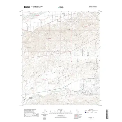
2018 Map of Moorpark
USGS Topo · Published 2018About this map
Bardsdale and the Santa Clara River corridor anchor the northern reaches of this Ventura County landscape, where agriculture meets the foothills of Oak Ridge. The transition from the alluvial plains of the Little Simi Valley to the uplifted Las Posas Hills is clearly marked by the winding routes of Arroyo Simi and Arroyo Las Posas. In the early 21st century, these drainage patterns continue to dictate the placement of established settlements like Somis and the residential clusters of Moorpark Home Acres.
Find a feature on this map
51 named features on this map. Tap any name to fly to it.
Don’t see what you’re looking for? This feature index may not catch every label — zoom into the map to look around manually.
Map Details
Editions of this 2018 Moorpark Map
This is the sole edition of this map. No revisions or reprints were ever made.
Other maps of this area

1900 · Triunfo Pass
USGS Topo · 1:62,500

1900 · Piru
USGS Topo · 1:62,500

1903 · Santa Paula
USGS Topo · 1:62,500

1903 · Camulos
USGS Topo · 1:125,000

1904 · Hueneme
USGS Topo · 1:62,500

1921 · Piru
USGS Topo · 1:62,500

1921 · Triunfo Pass
USGS Topo · 1:62,500

1941 · Piru
USGS Topo · 1:62,500

1942 · Santa Paula
USGS Topo · 1:62,500

1942 · Hueneme
USGS Topo · 1:62,500