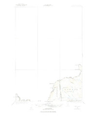
1927 Map of Moose Bog
USGS Topo · Published 1978About this map
Bowman and Parmachenee represent a high-country borderland where the boundaries of Maine, New Hampshire, and Quebec converge. Surveyed in 1927 by J.I. Gayetty and Crawford Dickey, this map documents a remote stretch of the North Woods dominated by timberlands and rugged peaks. The presence of the Bowman Farm in the shadow of Bowman Hill indicates the sparse agricultural footprint that once existed alongside the logging economy of the Third East Branch Magalloway River. This geography is defined by high elevations like Mount D'Urban and Saddle Hill, which served as critical landmarks for the International Boundary Commission. The map captures a moment before large-scale industrial changes, showing the primitive Road and trail network that connected isolated outposts to the larger river systems of Oxford County and Coos County.
Find a feature on this map
18 named features on this map. Tap any name to fly to it.
Don’t see what you’re looking for? This feature index may not catch every label — zoom into the map to look around manually.
Map Details
Editions of this 1927 Moose Bog Map
3 editions found
Other maps of this area

1925 · Indian Stream
USGS Topo · 1:48,000

1926 · Indian Stream
USGS Topo · 1:62,500

1927 · Indian Stream
USGS Topo · 1:62,500

1927 · Moose Bog
USGS Topo · 1:48,000

1927 · Second Lake
USGS Topo · 1:62,500

1931 · Cupsuptic
USGS Topo · 1:48,000

1931 · Moose Bog
USGS Topo · 1:62,500

1932 · Second Lake
USGS Topo · 1:62,500

1932 · Arnold Pond
USGS Topo · 1:48,000

1934 · Cupsuptic
USGS Topo · 1:62,500