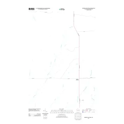
2013 Map of Moose Junction
USGS Topo · Published 2013About this map
Moose Junction serves as the central crossing point in this section of Douglas County, where S State Road 35 intersects with E Moose Rd and Co Hwy-M. The landscape is defined by its intricate drainage network, with the Spruce River and Toad Cr meandering across the terrain. To the southeast, the Upper Tamarack River and Chases Brook flow through the region, illustrating the importance of these waterways in shaping the local geography. The map also records rural transport routes such as E Summit Trl and Mihna Rd, reflecting the sparse but deliberate settlement pattern characteristic of northwestern Wisconsin. This 2013 survey provides a clear view of the area's modern infrastructure and natural hydrology, from Dingle Cr in the west to the forests and fields surrounding the primary road junctions.
Find a feature on this map
12 named features on this map. Tap any name to fly to it.
Don’t see what you’re looking for? This feature index may not catch every label — zoom into the map to look around manually.
Map Details
Editions of this 2013 Moose Junction Map
This is the sole edition of this map. No revisions or reprints were ever made.
Other maps of this area

1949 · Danbury
USGS Topo · 1:48,000

1949 · Holyoke
USGS Topo · 1:48,000

1949 · Webb Lake
USGS Topo · 1:48,000

1949 · Patzau
USGS Topo · 1:48,000

1953 · Duluth
USGS Topo · 1:250,000

1954 · Foxboro
USGS Topo · 1:24,000

1954 · Amnicon Lake
USGS Topo · 1:24,000
1954 · Patzau
USGS Topo · 1:24,000

1955 · Webb Lake
USGS Topo · 1:62,500

1955 · Patzau
USGS Topo · 1:62,500