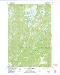
1983 Map of Moose Junction
USGS Topo · Published 1983About this map
The Belden Swamp dominates the northern reaches of this landscape, a significant wetland complex that shapes the local geography and road network. This early 1980s survey captures a transition between the townships of Summit and Dairyland in Douglas County. The small settlement of Moose Junction serves as the primary point of human activity, situated near the intersection of Moose Road and local transit routes.
Find a feature on this map
16 named features on this map. Tap any name to fly to it.
Don’t see what you’re looking for? This feature index may not catch every label — zoom into the map to look around manually.
Map Details
Editions of this 1983 Moose Junction Map
This is the sole edition of this map. No revisions or reprints were ever made.
Other maps of this area

1949 · Danbury
USGS Topo · 1:48,000

1949 · Holyoke
USGS Topo · 1:48,000

1949 · Webb Lake
USGS Topo · 1:48,000

1949 · Patzau
USGS Topo · 1:48,000

1953 · Duluth
USGS Topo · 1:250,000

1954 · Foxboro
USGS Topo · 1:24,000

1954 · Amnicon Lake
USGS Topo · 1:24,000
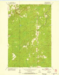
1954 · Patzau
USGS Topo · 1:24,000

1955 · Webb Lake
USGS Topo · 1:62,500

1955 · Patzau
USGS Topo · 1:62,500