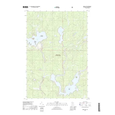
2018 Map of Moose Lake
USGS Topo · Published 2018About this map
Moose Lake and Lost Land Lake anchor this portion of the Chequamegon National Forest in Sawyer County. The landscape is defined by the complex aquatic network of the West Fork Chippewa River and the Teal River, which feed into major flowages and glacial lakes. This environment is punctuated by numerous named islands, such as Folson Island and Paradise Island, suggesting a long-standing recreational and seasonal residency pattern in the Northwoods. A notable feature of the local road network is the label Fish Trap, indicating specific points of access or historical landmarks along the water's edge. From Ghost Lake in the north to the southern reaches of the Chippewa, the map details a region where water management, through features like the Balsam Cr Flowage, has shaped the contemporary geography.
Find a feature on this map
30 named features on this map. Tap any name to fly to it.
Don’t see what you’re looking for? This feature index may not catch every label — zoom into the map to look around manually.
Map Details
Editions of this 2018 Moose Lake Map
This is the sole edition of this map. No revisions or reprints were ever made.
Other maps of this area

1942 · Clam Lake
USGS Topo · 1:48,000

1943 · Namekagon Lake
USGS Topo · 1:48,000

1944 · Draper
USGS Topo · 1:48,000

1944 · Radisson
USGS Topo · 1:48,000

1945 · Namekagon Lake
USGS Topo · 1:48,000

1945 · Clam Lake
USGS Topo · 1:48,000

1947 · Draper
USGS Topo · 1:48,000

1949 · Radisson
USGS Topo · 1:48,000

1953 · Ashland
USGS Topo · 1:250,000

1953 · Rice Lake
USGS Topo · 1:250,000