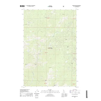
2020 Map of Moose Mountain
USGS Topo · Published 2020About this map
The North Fork Clearwater River carves a deep path through the Clearwater National Forest, defining the central drainage of this mountainous Clearwater County landscape. Dominated by prominent high points such as Moose Mtn and Elizabeth Mtn, the terrain is marked by a complex network of steep ridges and drainages including Pot Mtn Ridge and the sharp Elizabeths Finger. The narrow Black Canyon serves as a primary corridor for the Black Canyon Rd, which provides one of the few managed access routes through the dense forest. From the heights of Birch Ridge and Hornet Point to the secluded waters of Independence Cr and Moose Cr, this map documents a wilderness area where natural landmarks and federal forest boundaries take precedence over human settlements.
Find a feature on this map
47 named features on this map. Tap any name to fly to it.
Don’t see what you’re looking for? This feature index may not catch every label — zoom into the map to look around manually.
Map Details
Editions of this 2020 Moose Mountain Map
This is the sole edition of this map. No revisions or reprints were ever made.
Other maps of this area

1911 · Lolo
USGS Topo · 1:250,000

1913 · Lolo
USGS Topo · 1:250,000

1956 · Hamilton
USGS Topo · 1:250,000

1959 · Hamilton
USGS Topo · 1:250,000

1960 · Hamilton
USGS Topo · 1:250,000
1963 · Elizabeth Lake
USGS Topo · 1:24,000
1963 · Bacon Peak
USGS Topo · 1:24,000

1964 · Hamilton
USGS Topo · 1:250,000
1965 · Hoodoo Pass
USGS Topo · 1:24,000

1965 · Osier Ridge
USGS Topo · 1:24,000