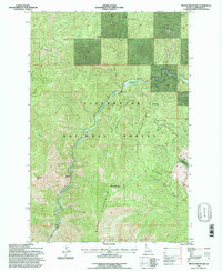
1994 Map of Moose Mountain
USGS Topo · Published 1997About this map
The North Fork Clearwater River carves a deep canyon through the heart of the Clearwater National Forest in this 1990s survey. The landscape is defined by the sharp verticality of the Moose Mountains, where peaks like Moose Mountain and ridges such as Pot Mountain Ridge dominate the horizon. This mid-1990s revision, based on earlier 1959 photography, illustrates the enduring wilderness character of the Idaho backcountry, showing a terrain largely undisturbed by major infrastructure.
Find a feature on this map
25 named features on this map. Tap any name to fly to it.
Don’t see what you’re looking for? This feature index may not catch every label — zoom into the map to look around manually.
Map Details
Editions of this 1994 Moose Mountain Map
This is the sole edition of this map. No revisions or reprints were ever made.
Other maps of this area

1911 · Lolo
USGS Topo · 1:250,000

1913 · Lolo
USGS Topo · 1:250,000

1956 · Hamilton
USGS Topo · 1:250,000

1959 · Hamilton
USGS Topo · 1:250,000

1960 · Hamilton
USGS Topo · 1:250,000
1963 · Elizabeth Lake
USGS Topo · 1:24,000
1963 · Bacon Peak
USGS Topo · 1:24,000

1964 · Hamilton
USGS Topo · 1:250,000
1965 · Hoodoo Pass
USGS Topo · 1:24,000

1965 · Osier Ridge
USGS Topo · 1:24,000