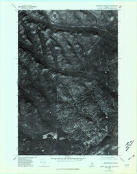
1975 Map of Mooseleuk Lake NW
USGS Topo · Published 1981About this map
Dense woodland and intricate drainage systems define this Aroostook County landscape as it appeared in the mid-1970s. The orthophotoquad captures a detailed overhead view of the Maine wilderness, emphasizing the natural hydrology of the region. Notable water bodies include Pratt Lake in the southeast and Farrar Pond to its west, both serving as central points for local drainage. This imagery provides a distinct perspective on the forest structure and waterway patterns that defined the area before modern commercial timber harvesting practices evolved. Significant stream systems like Indian Brook and Ten Mile Brook carve through the heavy canopy, while Rocky Brook and Pratt Lake Str further illustrate the interconnected nature of this watershed. For researchers of Maine's environmental history, this map preserves the specific state of the North Woods at a precise moment in the late twentieth century.
Find a feature on this map
6 named features on this map. Tap any name to fly to it.
Don’t see what you’re looking for? This feature index may not catch every label — zoom into the map to look around manually.
Map Details
Editions of this 1975 Mooseleuk Lake NW Map
This is the sole edition of this map. No revisions or reprints were ever made.
Other maps of this area

1931 · Fish River Lake
USGS Topo · 1:48,000

1931 · Mooseleuk Lake
USGS Topo · 1:48,000

1932 · Musquacook Lakes
USGS Topo · 1:48,000

1932 · Allagash Falls
USGS Topo · 1:48,000

1935 · Musquacook Lakes
USGS Topo · 1:62,500

1935 · Fish River Lake
USGS Topo · 1:62,500

1935 · Mooseleuk Lake
USGS Topo · 1:62,500

1935 · Allagash Falls
USGS Topo · 1:62,500

1954 · Presque Isle
USGS Topo · 1:250,000

1956 · Allagash Falls
USGS Topo · 1:50,000