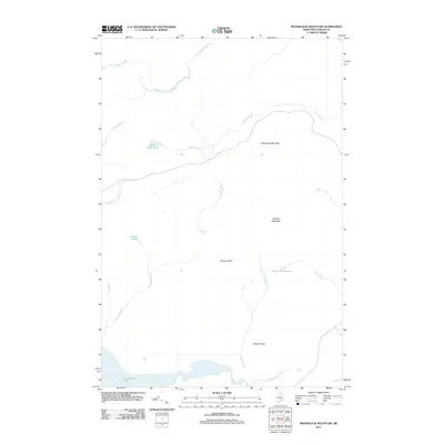
2011 Map of Mooseleuk Mountain
USGS Topo · Published 2011About this map
Mooseleuk Mountain and the surrounding wilderness of Piscataquis County are defined by a complex drainage network feeding into Munsungan Lake at the southern edge of the survey. The terrain is characterized by high points like Willard Mountain and the distinct Norway Bluff, which overlook a series of isolated water bodies including Smith Brook Pond, Norway Pond, and Brown Brook Pond. This area remains largely undeveloped, with a landscape shaped primarily by the natural flow of water through Yerxa Brook, Willard Brook, and the East Branch Atkins Brook. The concentration of named ridges and brooks suggests a landscape utilized for its timber resources or by those navigating the backcountry. The absence of traditional settlements emphasizes the role of these topographic landmarks and watersheds in defining boundaries and navigation in the North Woods.
Find a feature on this map
17 named features on this map. Tap any name to fly to it.
Don’t see what you’re looking for? This feature index may not catch every label — zoom into the map to look around manually.
Map Details
Editions of this 2011 Mooseleuk Mountain Map
This is the sole edition of this map. No revisions or reprints were ever made.
Other maps of this area

1931 · Mooseleuk Lake
USGS Topo · 1:48,000

1932 · Musquacook Lakes
USGS Topo · 1:48,000

1935 · Musquacook Lakes
USGS Topo · 1:62,500

1935 · Mooseleuk Lake
USGS Topo · 1:62,500

1954 · Spider Lake
USGS Topo · 1:62,500

1954 · Millinocket Lake
USGS Topo · 1:62,500

1954 · Presque Isle
USGS Topo · 1:250,000

1958 · Presque Isle
USGS Topo · 1:250,000

1960 · Presque Isle
USGS Topo · 1:250,000

1961 · Spider Lake
USGS Topo · 1:62,500