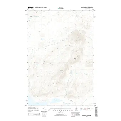
2014 Map of Mooseleuk Mountain
USGS Topo · Published 2014About this map
Mooseleuk Mountain and Norway Bluff dominate this northern Maine wilderness, part of the unorganized territory in Piscataquis County. The landscape is defined by its drainage basins, with Yerxa Brook and Norway Brook feeding into the significant water bodies of Munsungan Lake and Little Munsungan Lake at the southern edge of the survey. Unlike more settled areas, this region is characterized by a network of logging and access routes such as Pelletier Rd and Island Pond Rd, which wind through the elevations of Willard Ridge and past isolated waters like Norway Pond. The contouring reveals the steep relief of Willard Mtn, providing a look at the commercial timberlands of the North Maine Woods as they appeared in the early 21st century.
Find a feature on this map
23 named features on this map. Tap any name to fly to it.
Don’t see what you’re looking for? This feature index may not catch every label — zoom into the map to look around manually.
Map Details
Editions of this 2014 Mooseleuk Mountain Map
This is the sole edition of this map. No revisions or reprints were ever made.
Other maps of this area

1931 · Mooseleuk Lake
USGS Topo · 1:48,000

1932 · Musquacook Lakes
USGS Topo · 1:48,000

1935 · Musquacook Lakes
USGS Topo · 1:62,500

1935 · Mooseleuk Lake
USGS Topo · 1:62,500

1954 · Spider Lake
USGS Topo · 1:62,500

1954 · Millinocket Lake
USGS Topo · 1:62,500

1954 · Presque Isle
USGS Topo · 1:250,000

1958 · Presque Isle
USGS Topo · 1:250,000

1960 · Presque Isle
USGS Topo · 1:250,000

1961 · Spider Lake
USGS Topo · 1:62,500