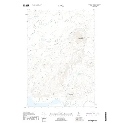
2018 Map of Mooseleuk Mountain
USGS Topo · Published 2018About this map
Mooseleuk Mtn and Willard Mtn define this remote interior section of Piscataquis County, where the landscape is shaped by the headwaters and drainage basins of the North Maine Woods. In the southern reach, the significant expanse of Munsungan Lake feeds into Munsungan Stream, a primary hydrological feature of the region. This 2018 survey reveals a modern network of forestry and access routes, including Pell and Pell Rd and Munsungan Rd, which thread through the high country between Norway Bluff and Willard Ridge. The terrain is punctuated by numerous small basins and catchments such as Norway Pond, Little Hudson Pond, and Smith Brook Pond, reflecting the dense hydrography typical of the Maine wilderness before these waters reach larger river systems.
Find a feature on this map
21 named features on this map. Tap any name to fly to it.
Don’t see what you’re looking for? This feature index may not catch every label — zoom into the map to look around manually.
Map Details
Editions of this 2018 Mooseleuk Mountain Map
This is the sole edition of this map. No revisions or reprints were ever made.
Other maps of this area

1931 · Mooseleuk Lake
USGS Topo · 1:48,000

1932 · Musquacook Lakes
USGS Topo · 1:48,000

1935 · Musquacook Lakes
USGS Topo · 1:62,500

1935 · Mooseleuk Lake
USGS Topo · 1:62,500

1954 · Spider Lake
USGS Topo · 1:62,500

1954 · Millinocket Lake
USGS Topo · 1:62,500

1954 · Presque Isle
USGS Topo · 1:250,000

1958 · Presque Isle
USGS Topo · 1:250,000

1960 · Presque Isle
USGS Topo · 1:250,000

1961 · Spider Lake
USGS Topo · 1:62,500