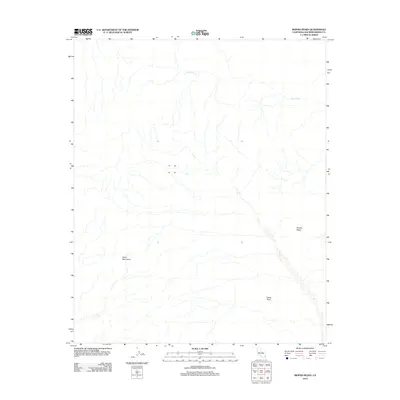
2012 Map of Mopah Peaks
USGS Topo · Published 2012About this map
Turtle Mountains dominate this arid landscape in eastern San Bernardino County, where the topography is defined by ancient volcanic formations and desert drainage systems. The map prominently features the distinctive Mopah Peaks and the towering landmark of Castle Rock, both of which have served as critical navigational beacons for travelers through the Mojave Desert for generations. Natural water flow is ephemeral here, traced by the course of Gary Wash as it winds through the northern portion of the quadrangle. This 2012 survey captures the area's geological character with precision, documenting the primary peaks and landforms that have remained constant while surrounding road networks and infrastructure evolved on the desert floor.
Find a feature on this map
4 named features on this map. Tap any name to fly to it.
Don’t see what you’re looking for? This feature index may not catch every label — zoom into the map to look around manually.
Map Details
Editions of this 2012 Mopah Peaks Map
This is the sole edition of this map. No revisions or reprints were ever made.
Other maps of this area

1943 · Turtle Mts.
USGS Topo · 1:62,500

1943 · Vidal
USGS Topo · 1:62,500

1949 · Vidal
USGS Topo · 1:62,500

1950 · Vidal
USGS Topo · 1:62,500

1950 · Savahia Peak
USGS Topo · 1:62,500

1951 · Savahia Peak
USGS Topo · 1:62,500

1954 · Needles
USGS Topo · 1:250,000

1954 · Turtle Mountains
USGS Topo · 1:62,500

1954 · Rice
USGS Topo · 1:62,500

1956 · Needles
USGS Topo · 1:250,000