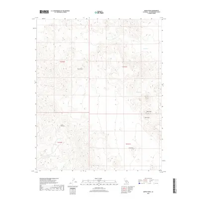
2018 Map of Mopah Peaks
USGS Topo · Published 2018About this map
Mopah Peaks dominate the eastern landscape of this 2018 survey, providing a focal point for the Mopah Range in San Bernardino County. This desert terrain, part of the wider Mojave Desert, is characterized by dramatic topographic rises and deep drainage systems like Gary Wash. The presence of Mopah Spring indicates a critical water source in an otherwise arid environment, essential for the local ecology of the Turtle Mountains. Farther south, the distinct formation of Castle Rock stands as a prominent landmark. The map illustrates the complex ridgelines and elevation changes that define this corner of California, showing the relationship between these peaks and the surrounding washes that channel seasonal runoff across the basin.
Find a feature on this map
11 named features on this map. Tap any name to fly to it.
Don’t see what you’re looking for? This feature index may not catch every label — zoom into the map to look around manually.
Map Details
Editions of this 2018 Mopah Peaks Map
This is the sole edition of this map. No revisions or reprints were ever made.
Other maps of this area

1943 · Turtle Mts.
USGS Topo · 1:62,500

1943 · Vidal
USGS Topo · 1:62,500

1949 · Vidal
USGS Topo · 1:62,500

1950 · Vidal
USGS Topo · 1:62,500

1950 · Savahia Peak
USGS Topo · 1:62,500

1951 · Savahia Peak
USGS Topo · 1:62,500

1954 · Needles
USGS Topo · 1:250,000

1954 · Turtle Mountains
USGS Topo · 1:62,500

1954 · Rice
USGS Topo · 1:62,500

1956 · Needles
USGS Topo · 1:250,000