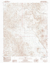
1985 Map of Mopah Peaks
USGS Topo · Published 1985About this map
The Turtle Mountains dominate this high-desert landscape in eastern San Bernardino County, where dramatic volcanic topography meets the alluvial plains. This 1985 provisional study captures the area's geological complexity, centered on the distinctive Mopah Peaks and the prominent Castle Rock landmark to the south. The presence of Mopah Spring provides a rare point of historical water access in an otherwise arid environment characterized by extensive drainage systems like Gary Wash. The transition from the high peaks into the broad Vidal Valley reveals a classic Basin and Range terrain pattern, with the mountain front dropping sharply to the valley floor. Researchers and geologists can trace the intricate contouring of the range, which serves as a vital record of this protected wilderness area's natural state before late-twentieth-century shifts in land management.
Find a feature on this map
7 named features on this map. Tap any name to fly to it.
Don’t see what you’re looking for? This feature index may not catch every label — zoom into the map to look around manually.
Map Details
Editions of this 1985 Mopah Peaks Map
This is the sole edition of this map. No revisions or reprints were ever made.
Other maps of this area

1943 · Turtle Mts.
USGS Topo · 1:62,500

1943 · Vidal
USGS Topo · 1:62,500

1949 · Vidal
USGS Topo · 1:62,500

1950 · Vidal
USGS Topo · 1:62,500

1950 · Savahia Peak
USGS Topo · 1:62,500

1951 · Savahia Peak
USGS Topo · 1:62,500

1954 · Needles
USGS Topo · 1:250,000

1954 · Turtle Mountains
USGS Topo · 1:62,500

1954 · Rice
USGS Topo · 1:62,500

1956 · Needles
USGS Topo · 1:250,000